

How Survey Crews Map Land: Instruments and Professional Roles

Introduction
Survey crews are the professionals responsible for establishing the spatial relationships on the Earth’s surface. Their mission is to meticulously measure and record land features—including angles, elevations, and distances—to create accurate maps and digital records. Whether the task is mapping a new construction site or establishing permanent property boundaries, the work of a land surveying team integrates highly specialized technology with rigorous field execution. The central function of a survey crew member is not merely to measure, but to ensure that every point on the ground relates accurately to a predefined coordinate system.
Modern surveying has evolved from manual measurements to integrating sophisticated global systems. However, regardless of the technology used, the core principle remains the same: using precise data collection to ensure that the final map or design aligns perfectly with reality.
The Tools of Precision: How Survey Crews Measure Land
The precision of a survey is directly dependent on the instrumentation employed. Survey crews utilize complex, highly calibrated equipment to gather the necessary data points. The key process involves defining points, measuring the angles between them, and measuring the vertical difference in elevation.
Traditional vs. Modern Instrumentation
Historically, surveying relied on instruments like theodolites (for measuring horizontal and vertical angles) and transit levels (for measuring subtle changes in ground elevation). While these traditional tools remain foundational, modern survey crews primarily depend on integrated systems.
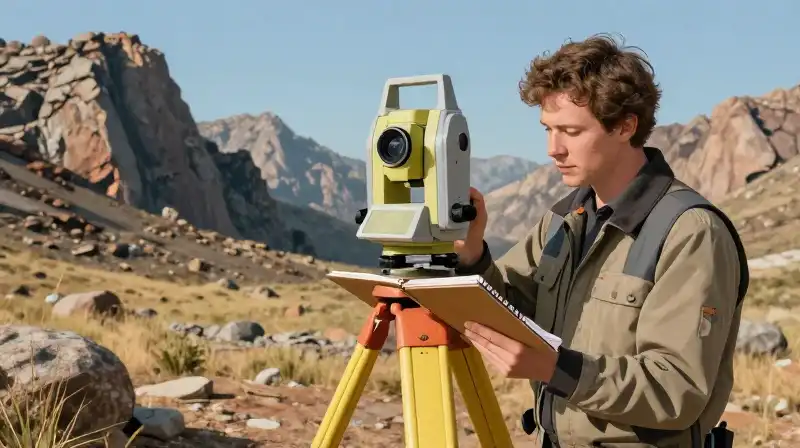
- Total Station: This is a primary tool that combines the function of a theodolite with electronic distance measurement (EDM). It allows a single operator to measure both angles and distances instantly, drastically increasing efficiency.
- Global Navigation Satellite Systems (GNSS): Modern equipment integrates high-performance GNSS receivers (like GPS) to provide real-time global positioning. This allows crews to pinpoint coordinates with high accuracy, even in open terrain.
- Line of Sight: Many instruments are kept mounted on tall tripods or poles to ensure the operator has an unobstructed line of sight over uneven terrain, parked vehicles, or dense brush, guaranteeing the measurements are taken from the correct vantage point.
The Science of Triangulation and Benchmarks
Surveys rely on the principles of triangulation. By measuring the angles and known distances between several points, the crew can mathematically calculate the unknown coordinates of other points on the land. This meticulous process ensures that the entire survey remains cohesive and measurable.
To maintain this accuracy, the entire project is tied to established, verifiable reference points known as benchmarks. These permanent points serve as fixed control nodes. The goal of the survey is to achieve “closure”—meaning the final calculated positions align perfectly with the starting positions, proving the measurements were taken without systematic error.
The Roles on the Ground: The Hierarchy of the Field
A typical survey crew is a small but highly specialized team, requiring diverse skill sets to execute a project successfully. The work is a mix of highly technical operation and physically demanding labor.
Key Roles and Responsibilities
The roles within a crew vary, often depending on the scale and complexity of the project. Understanding these positions is key to understanding the workflow of a land survey crew.
| Role | Primary Function | Core Responsibilities |
|---|---|---|
| Crew Chief / Party Chief | Direct Supervision and Strategy | Oversees the entire operation, manages timing, interprets complex field data, and ensures adherence to project specifications and safety protocols. |
| Instrument Operator | Technical Operation | Operates the specialized equipment (Total Station, GNSS). Responsible for data collection, setup, and ensuring the instrument is calibrated correctly. |
| Field Technician / Rod-man | Target Management and Logistics | Holds targets, poles, or reflectors used by the instrument operator. Performs physically demanding tasks like cutting brush, staking out lines, and clearing the line of survey. |
| Apprentice | Learning and Support | Assists the Party Chief in field tasks, learning the protocols for staking, marking, and data recording before performing tasks independently. |
From a practical standpoint, the role of a survey crew member often involves more than just standing by a tripod. Crew members are frequently required to physically clear trees and brush, carry heavy equipment across rough terrain, and operate survey vehicles, demonstrating a need for both technical aptitude and physical stamina.
Project Applications for Land Survey Crews
Land surveying is not a standalone discipline; it is a critical input for almost every civil engineering, construction, and planning project. Survey crews perform specialized activities depending on the client’s needs:
- Boundary Surveys: Establishing and legally defining the boundaries of a parcel of land.
- Topographic Surveys: Mapping the natural contours and features of a piece of land, often used for drainage planning and erosion control.
- Construction Stakeout: Precisely marking the locations, elevations, and alignments (stakes) where structures, roads, or utilities need to be built, ensuring construction begins exactly where it should.
- As-Built Surveys: Documenting the exact final position and dimensions of a structure or infrastructure *after* construction is complete, for official record-keeping.
- Aerial and Satellite Mapping: Using remote sensing technology to gather large-scale terrain details quickly, supplementing traditional ground-based measurements.
Understanding the Profession: Career Entry and Compensation
A career in surveying is highly specialized, requiring a strong commitment to accuracy and field safety. The path often involves starting as an apprentice, learning under a Party Chief, and moving toward becoming a Surveyor Technician or a certified Land Surveyor.
Career Requirements and Opportunities
Prerequisites for entry typically include a valid driver’s license, a commitment to an apprenticeship, and a strong technical understanding of outdoor field safety. While educational background varies by role, those who advance into professional land surveying often require specific certifications.
Regarding compensation, salaries vary widely based on experience, geographic location, and the specific duties performed by the crew member. A survey crew member’s wage depends heavily on whether they are functioning as a field technician, instrument operator, or supervising Party Chief.
Note on Compensation: Specific salary data fluctuates by region and is dependent on the company’s size and project load. For general guidance, professionals seeking the specific rates for a survey crew member or a Survey Crew Chief in areas like North Carolina should consult current regional job market data or local professional directories.
Practical Insights for Survey Crew Members
Working for a survey crew requires a specific set of competencies beyond simply operating instruments. Here are two crucial practical aspects of the job:
Critical Skill Assessment: Tech vs. Field Work
When considering a role, prospective candidates must assess whether their interests lean toward high-tech operation or rugged field work. Both are necessary, but their demands differ:
- If you prioritize technical mastery: Focus on roles involving the Total Station or GNSS data processing. This requires a strong grasp of geospatial data and equipment calibration.
- If you prioritize physical field expertise: Focus on roles like Field Technician. This demands resilience, the ability to work in varied outdoor environments, and proficiency in manual tasks (staking, clearing, marking).
The Importance of Data Integrity
A core qualification for any crew member is the commitment to data integrity. In surveying, small measurement errors can lead to significant construction failures or legal disputes. Therefore, continuous attention to details, adherence to established field safety practices, and meticulous record-keeping are mandatory.
By understanding the blend of precision technology and demanding physical labor, you gain a comprehensive view of how a survey crew successfully translates the complexities of the Earth’s surface into usable, actionable maps and records.
Frequently Asked Questions
How much does a survey crew member make?
Salaries for survey crew members vary widely based on experience, geographic location, and the specific duties performed, including functioning as a field technician, instrument operator, or supervising Party Chief. Specific salary data is dependent on the companys size and project load.
How much does a survey crew chief make in NC?
The article does not provide specific salary data for a survey crew chief in North Carolina, as compensation varies widely based on experience, geographic location, and specific duties. Professionals seeking these rates should consult current regional job market data or local professional directories.
Related Articles